China Map

This website's Main Pages (click to go there)   Home 主页    Current Update 当前更新    Resources 学习资源    Photos 影集 

  Links 友情链接    Things We've Written 我的文集   Special Features 本站特色    Site Map 本站导航    Real World 英语写作 

I've stopped updating this website, though it's pages will remain for a while. See "current update" for details.

Visit instead: wp.krigline.com and EFLsuccess.com

If the above links don't work, try these: (see "use-policy" regarding technical difficulties)

    Home    Current Update    Resources    Photos    Links    Things We've Written   Special Features    Site Map    Real World  ◘ 

Maps of China
"Up" takes you to "Introduction to China"

Sister-pages:   Home Up Life in China Life in China (2) Chinese Medical Care(1) Chinese Medical Care(2) Health Issues in China Friendship Award 2008 China Map Intro to China (中文)

(▲ Links to the pages at the same level as this page. If you can't see the label, put your mouse over a button and look at the bottom of your browser.)

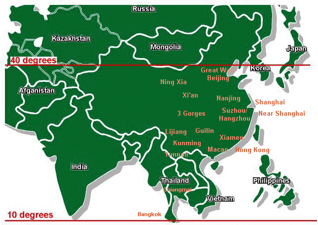
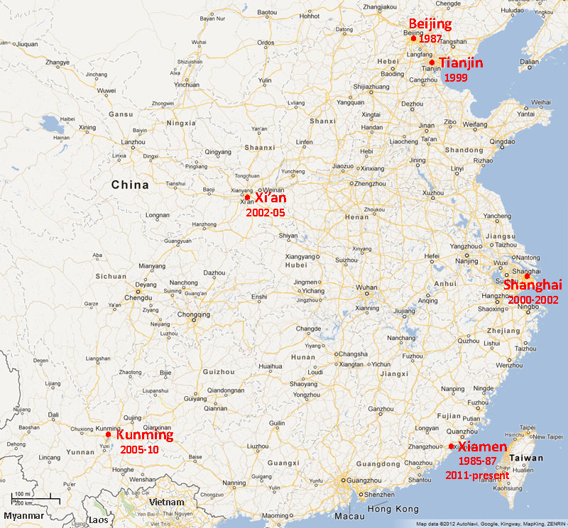
Scroll down for: Map of China (with links to photo pages); Map of "Where We've Lived" in China


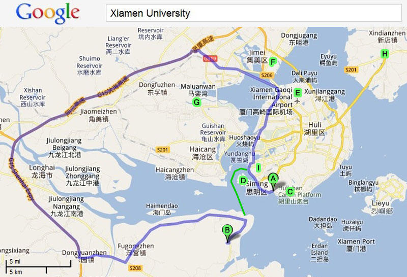
Map of the Xiamen area

MAP KEY

A=Xiamen University (original campus)

B=Xiamen/Tan Kah Kee University (Zhang-zhou campus)

C=Xiamen University Hai-yun Campus (and Shang-li area)

D=Gulangyu ("Piano Island")

E=Xiamen International Airport

F=Ji-mei (a suburb of Xiamen, with several universities)

G=Chang-geng Hospital (with English-speaking doctors)

H=Xiamen University (Xiang-an campus)

I=XICF (English-speaking church)

From Aug 2011 to July 2012, we were living at "B" on this map, in a small town (Zhang-zhou Development Zone), connected by ferry (green line) to the huge island-city of Xiamen (3.5 million?). Then we moved to "C", because the freshmen live and study near there (just a few bus stops away from "A" (the old Xiamen University campus, in Xiamen, where Michael studied in the 1980s). The other marked places come up in our other web pages. Click here for a map of how to get to our apartment in Shang-li. By the way, according to Google, "A" is about 100 km (60 miles) from "B" by road (blue line). That takes about two hours, but the ferry (green line) and special "teacher buses" cuts the trip to 50 minutes.

Click on the names below to see photos of these areas in China

(If they aren't working, you'll have to go to the sitemap--sorry!)


Where We've Lived

Have you seen our photos of China?

Click here for our Photo Album Index, or see the list of photo pages on our Site Map.


Maps on other websites:

 http://www.maps-of-china.net/chinamaps/enmap.html (China's provinces, in English)

http://www.maps-of-china.net/chinamaps/Bilingual%20.html (China's major cities, bilingual)

 [broken link?] http://www.maps-of-china.net/ (links to lots of other China maps)


介绍中国 Introduction to China in Chinese

Click in the boxes below to go to some of our most popular pages. If you get lost, just click "Home."

(There is a "search" box on the home page)

HOME

Site map (To search within any page, type "ctrl + f")

Current Update

& how to contact us

Resources  for students & teachers

Links for English Learners

EFL Movie Study Guides

Better Writing Study Guide

Our Students photos

Photo Index

South Carolina & USA photos

FAQ (Frequently Asked Questions)

Favorite Links

Things We've Written (articles)

Introduction to China

Life in China photos

Music Page & mp3 downloads

Archive Index

Real World Writing (my textbook)

See our Policy regarding the use of materials available at Krigline.com or Krigline.com.cn